Dit jaar ligt er een boel gravel en steenslag op de noordzijde (onze kant) en de weg aan de andere kant is bezaaid met verse lapjes teer met gravel erop... verder naar benede zijn er veel teer 'slangen', waar ze de vorstnaden hebben dichtgemaakt met een dikke teer strip waar je banden heerlijk over weg glijden. Ben er persoonlijk niet zo wild van!
De Madeleine is geen pas voor beginners. Smal, donker, gravel en steil, met flinke afgronden langs onbeschermde wegranden. Ik rij nu zo'n 40 jaar in de Alpen en ben nog steds blij dat dit niet mijn eerste pas was ;-)
Goed vooruit kijken en denken... je wilt hier geen vracjtwagem of bus in een haarspeld tegenkomen. Dat betekent stoppen. En dat betekent problemen.
Het weer is al dagen geweldig.... eigenlijk te warm voor het fijne... 33-35 C beneden. Dus maar gauw naar boven waar een windje waait en het 'maar' 27C is !
Nina heeft deze keer de meeste foto's gemaakt (nee, ik rij HIER niet met een handje om te fotograferen!), en de 2024-pix plaatjes staan op mijn Smugmug site:
http://europerides.smugmug.com/gallery/9098581_n2En6" onclick="window.open(this.href);return false;
De rest, I'm afraid... in het Engels.....
We did this on Wednesday afternoon, July 29th.
Here we start the climb from La Lechere.... 26 kilometers to the summit at 2000 meters (6500 feet).

Quite a few riders came down from the 'Maurienne side' ....

One of the reasons this pass is difficult at some places, is the width of the road - or rather the lack of it....

There are 3 or 4 little villages on the way up. I am always astounded that people live here.....

And on we go again, higher and higher.... the valley floor on the left sinks at an astounding tempo !

We already did dozens of turns and quite a few switchbacks, and still 16 kilometers to the pass!

More fellow riders.....


Good thing the European 'trucks' aren't as huge as the US ones.....


Another switchback coming up...... a wide one this time....

Managed that one too. As you can see, there is no (perceived) safety along the sides....

.... oh well, there are new concrete strips at some places.

... or a wooden fence sometimes.

Another little settlement....

This is the church of Celliers


Leaving 'town'.......

Another bridge and stream to cross....

After the last village, Celliers, the road gets a little bit wider, leaving the steep rock cliffs, canyons and forests....

You can see the road on the slope just at the top of those barns,running left. We'll stop at the far left of this photo for a look at the Mont Blanc !


This 'yellow jersey' had some lack of speed troubles and was all over the road !


Stopped and looking back down.....

Down there you can see the three barns we stopped earlier. And in the distance the mighty Mont Blanc again, raging 16,000 feet into the air.

The air was a lot less clean than a few days ago, casting a brown haze of pollution over our mountains..... and yes, our RT is part of the problem.

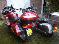
Big Bike and Small Lady


If the COWS can get here, surely an RT can.......

..... or their farmer with his tractor (left)


The reward for reaching the pass.... a view on the Alps behind it, looking in southern direction towards the Col de Galibier

I sorta 'overshot' the parking... looking for a suitable place to enter with a heavily laden RT and a pillion in less-than-perfect ATGATT I drove PAST the parkings and just over the pass there is NO PLACE to stop or turn. So we headed down the other ide for half a mile before I could turn around and give it another try.
But we managed.......


And... oh yes..... the 'sign'.....